
Vennen, heiden en moerassen rond Turnhout, Arendonk, Merksplas, Oud-Turnhout, Ravels en Turnhout
Image
General description
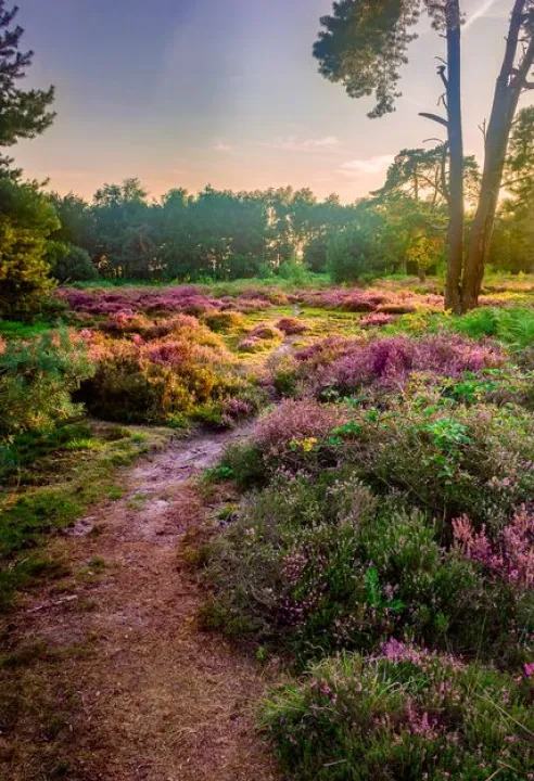
The Turnhout marshes are rustic heathland cores featuring typical fens, wet marsh landscapes, and dry forests. In the beautiful ponds, you can spot the great crested newt. The fens also host remarkable plant species such as the floating water-plantain.
Identification
The Turnhout marshes are located in the Noorderkempen region, in the northeastern part of the province of Antwerp. The Habitats Directive site comprises sixteen subareas spread across six municipalities. The Birds Directive site consists of two subareas, which are nearly entirely separated by the valley of the River Aa, with only a small point of connection.
Landscape description
In the 19th century, several canals were dug in the Kempen region to stimulate agriculture, as there was little surface water and the soils were poor and nutrient-deficient. Thanks to the canals, irrigation of the fields improved. Even today, many active farms remain in the region. These canals also provide adjacent natural areas with a high groundwater level, supporting rich spring vegetation in some places. The area is characterized by a great deal of open space, with hardly any housing, industry, or recreation.
Who is active in the area
The Agency for Nature and Forests owns 18% of the land and manages an additional 8% consisting of municipal forests and military domains. Natuurpunt owns 7% and manages another 2%. More than half of the area is private property. The Ministry of Defence operates in the military domain of Weelde. Agriculture is also a key player: half of the area is designated for agriculture and there are 415 active farms.
Click here to go to the Bioblitz page of this Natura 2000 area.
Click here to install Obsidentify.
Photo: Jurgen Cornelissen