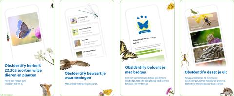
To map our biodiversity you can easily use the Obsidentify app. You can easily download this app via this QR-code or link or via your App or Play Store on your mobile device. The app is completely free and you can quickly create a login.
Want to join?!

Once you have installed the app, look at “challenges”. If all goes well, you will find the 'National Biodiversity Challenge' there during Biodiversity Week. All you have to do now is like the challenge and then you can get started. Take photos of as many plant and animal species as possible and let the app tell you what you saw. Complete your registration and… congratulations! You also helped map our biodiversity. Will your place or your community be the most biodiverse?
Do you want to go further than just your environment or garden? Would you like to know more about the species that occur in some selected Natura 2000 areas? Then click on the map below on a Natura 2000 area of your choice and find out all about it!
MAP N2000 AREAS
- Duingebied inclusief Ijzermonding en Zwin
- Poldercomplex
- Ijzermonding
- Durme en middenloop van de Schelde
- Heesbossen, Vallei van Marke en Merkske
- Zoniënwoud / Forêt de Soignes
- Valleigebied tussen Melsbroek, Kampenhout, Kortemberg en Veltem
- Vennen, heiden en moerassen rond Turnhout
- Vallée de la Haine en aval de Mons
- Vallée de la Thyle
- Bokrijk en omgeving
- Vallée de la Wimbe
- Vallée de l’Amblève du Pont de Targnon à Remouchamps
- Marais de la Haute-Semois et Bois de Heinsch

